MapGIS Digital Rural Construction Plan: GIS+AI Illuminates a New Landscape of Rural Revitalization
In the context of the deep integration of digital economy and rural revitalization in the new era, digital technology is becoming an important pivot to leverage the modernization of agriculture and rural areas. The No. 1 central document of the Central Committee of the CPC in 2025 once again emphasizes the comprehensive revitalization of rural areas through scientific and technological innovation, and requires accelerating the pace of digital transformation of agriculture and rural areas. In response to the national strategy, Zhongdi Digital Innovation has launched the MapGIS digital rural construction plan, providing a comprehensive and one-stop solution for rural digital transformation.
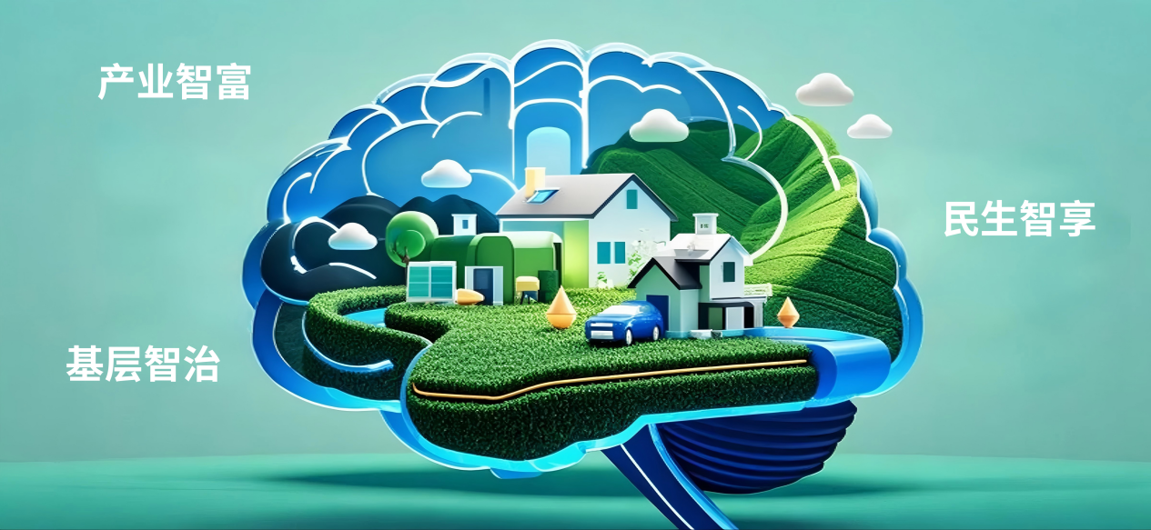
MapGIS digital village construction scheme makes full use of 5G, Internet of Things, mobile Internet, AI artificial intelligence and other technologies, gives full play to the advantages of GIS visualization, and takes the digital village brain as the center to build a comprehensive digital village intelligence platform that integrates data aggregation, analysis and processing, and application services. It deeply integrates various data resources in rural areas. Through the establishment of unified data standards and norms, data interconnection and sharing are realized, providing a solid data foundation for rural development.

Activate the new engine of rural economy
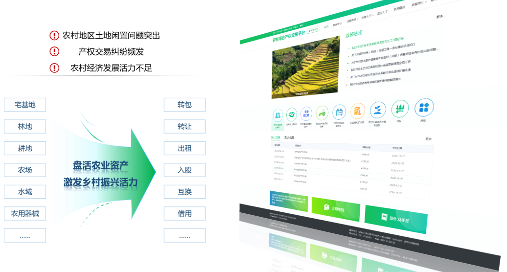
Currently, rural areas are facing challenges such as insufficient economic development vitality, frequent property rights disputes, and prominent issues of idle land. Therefore, rural land transfer is crucial for economic development. The rural land transfer and transaction service platform built by MapGIS digital rural construction scheme has created a convenient and transparent channel for land transfer. By integrating land information, precise matching and efficient circulation of land resources can be achieved, promoting large-scale and intensive agricultural management.
Agricultural germplasm resources are the core of agricultural development. The agricultural germplasm resource information service platform integrates various germplasm data, facilitating researchers and producers to share innovation, cultivate high-quality varieties, and promote sustainable agricultural development.

Drive the new upgrading of the agricultural industry
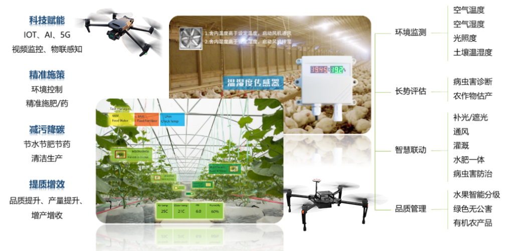
The application of IoT technology in the field of agriculture has made agricultural production more intelligent and efficient. The MapGIS digital rural construction plan utilizes IoT devices to monitor key indicators such as temperature, humidity, light intensity, soil temperature and humidity in the agricultural production environment in real time, creating the best environment for crop growth. With the help of AI and 5G technology, MapGIS has achieved comprehensive monitoring and intelligent management of agricultural production. Through data analysis, it diagnoses pests and diseases, estimates yield, and ensures real-time data transmission, enabling remote guidance and equipment control, making agricultural production more efficient.
In recent years, the low altitude economy has shown great potential in the agricultural field, and the MapGIS digital rural construction plan has actively introduced the concept of low altitude economy, using low altitude aircraft such as drones to carry out agricultural production operations, which can quickly obtain crop information and provide support for precision agriculture.

Creating a new style of beautiful countryside
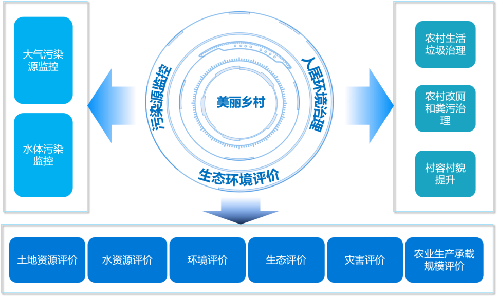
The improvement of rural living environment is an important part of the construction of beautiful countryside. The MapGIS digital rural construction plan utilizes GIS technology to comprehensively manage information on rural living environment infrastructure and governance work. By monitoring the operation of garbage treatment facilities, sewage treatment facilities, etc. in real time, problems can be identified and dealt with in a timely manner, promoting the improvement of rural living environment and creating a clean and beautiful rural environment.
The ecological environment is also a valuable asset for rural development. The plan provides scientific basis for rural ecological protection and sustainable development through comprehensive evaluation and monitoring of land resources, water resources, ecological environment, etc. Utilize spatial analysis functions to plan agricultural production layout reasonably, avoid damage to the ecological environment caused by excessive development, and achieve the healthy development of rural ecological environment.

Elevate rural management to new heights
Peace is the cornerstone of rural development. The MapGIS digital rural construction plan aims to build a comprehensive management platform for safe rural areas, utilizing technologies such as video surveillance, IoT sensing, and AI recognition to achieve comprehensive monitoring and early warning of rural security and fire safety. In response to natural disasters, the MapGIS platform collects real-time meteorological data and geological information to provide accurate warning and forecasting of natural disasters such as floods, droughts, and mudslides. By issuing early warning information and organizing villagers to take preventive measures, the losses caused by natural disasters have been effectively reduced.

In the future, Zhongdi Digital will continue to deeply cultivate the field of digital rural areas, continuously optimize the functions of MapGIS platform, and keep up with the pace of national rural revitalization policies. To continuously assist in realizing the beautiful vision of strong agriculture, beautiful rural areas, and prosperous farmers, and promote the comprehensive revitalization of rural areas to new heights.


