MapGIS IGServer-X is a big data GIS server product that integrates a distributed processing flow engine, providing distributed operators and services for vector big data, real-time big data, image big data, and text big data, enabling analysis and mining of multidimensional spatiotemporal big data.
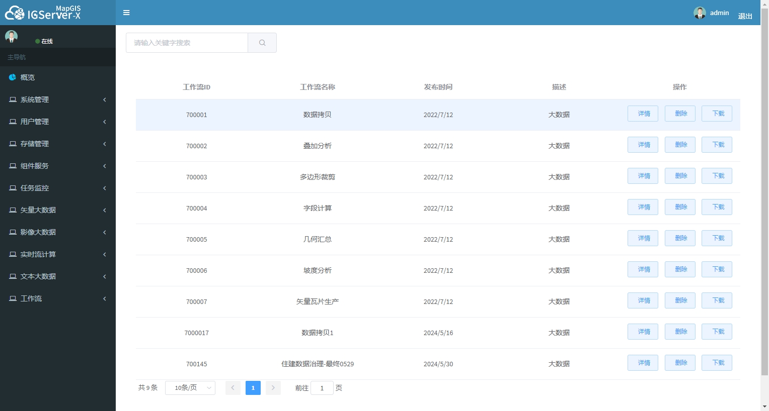
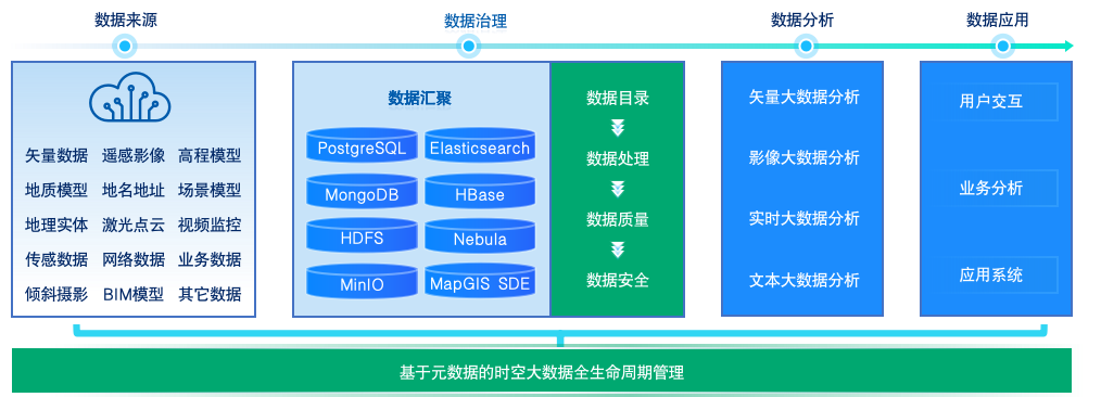
Complete spatiotemporal big data governance system
Establish a standardized governance process for spatiotemporal big data, providing high-quality data sources for spatiotemporal big data analysis
●Data aggregation supports fast access and aggregation of spatiotemporal big data from 20+data sources and 100+data formats
●The data directory provides visual directory rule configuration, enabling intelligent search and blood tracing based on metadata.
●Data processing provides different types of spatiotemporal big data processing tools to meet the fast processing requirements of spatiotemporal big data
●Quality control: Customize quality control processes based on spatiotemporal big data quality control standards to ensure that spatiotemporal big data is controllable and verifiable
●Establish a controllable security warning mechanism to enhance the security protection capability of spatiotemporal big data
Rich spatiotemporal big data distributed services
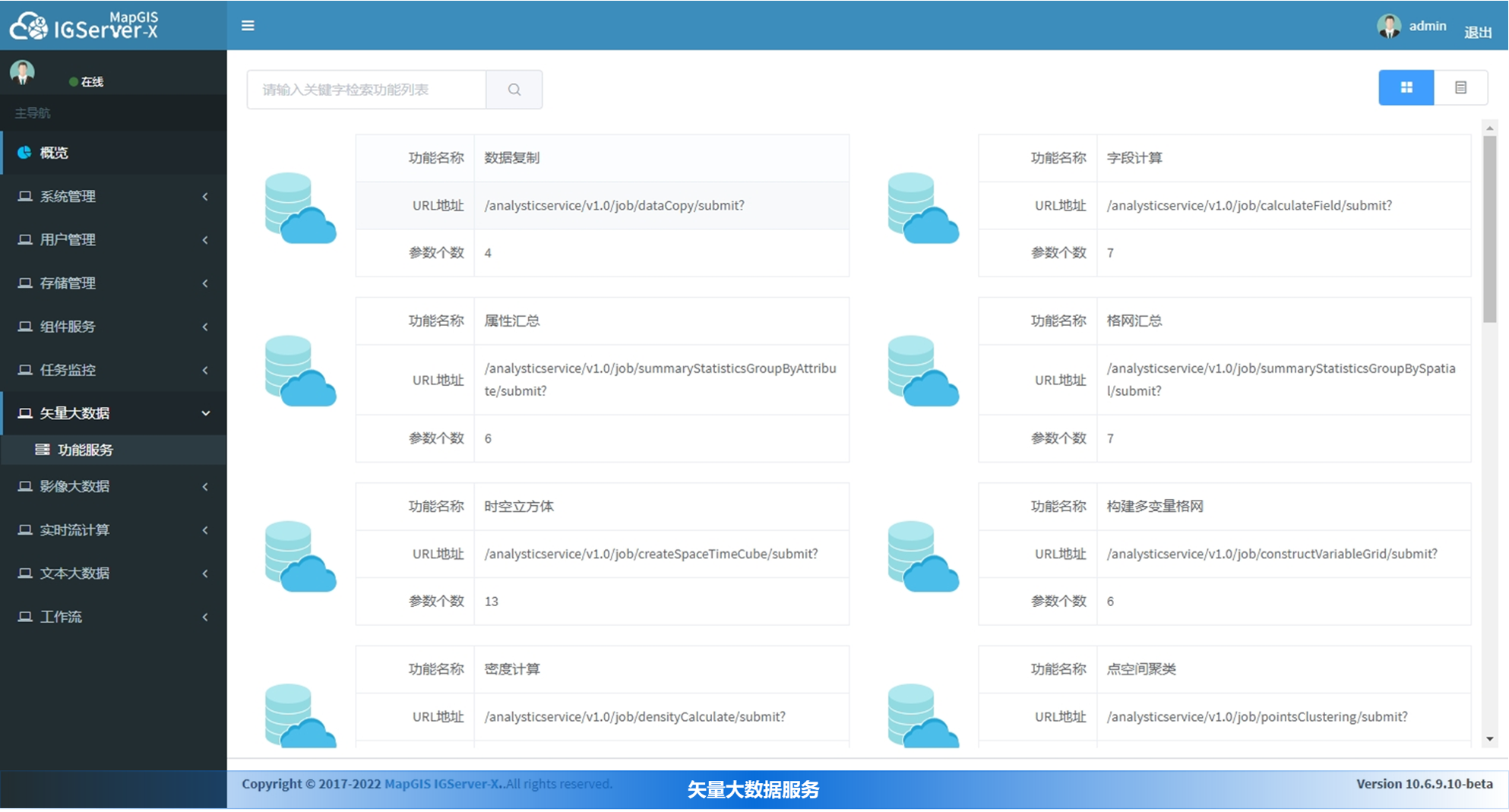
●Vector big data service, integrating GIS spatial analysis with Spark framework to provide rich distributed vector big data analysis services
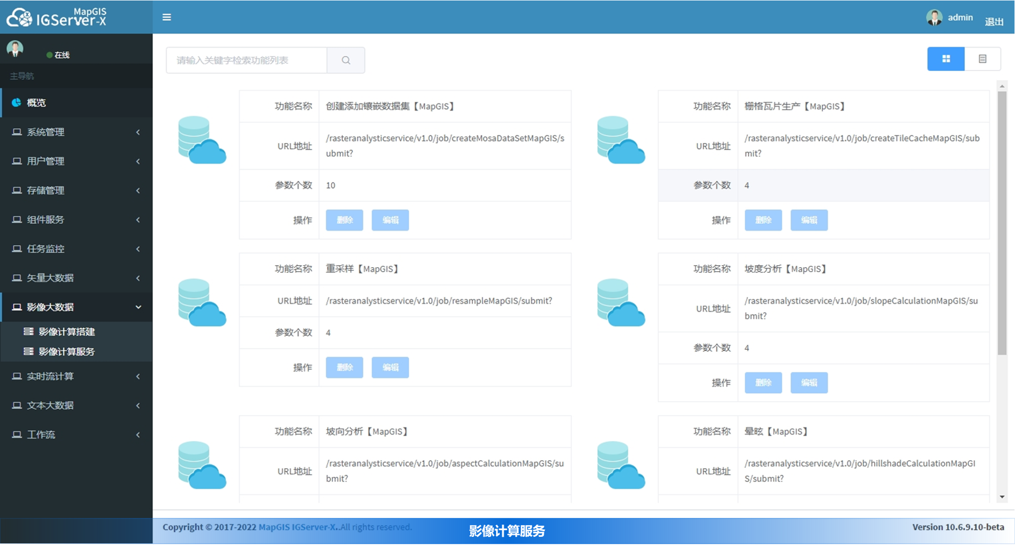
●Image big data service, providing image big data services based on embedded datasets, effectively improving the processing and analysis efficiency of large-scale images
●Real time big data services, providing real-time big data services based on Spark Streaming/Link, enhancing real-time data access, processing, and analysis capabilities
●Text big data service, providing distributed text big data services, supporting dynamic word segmentation and semantic association, quickly extracting and mining information
Convenient distributed processing flow engine
●Provide a distributed processing flow engine, based on a visual modeling environment, to quickly build geographic processing models through drag and drop methods
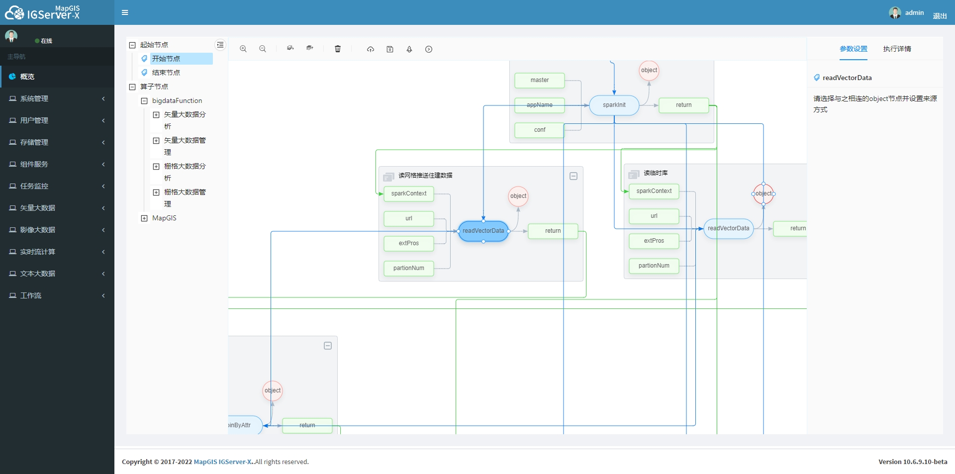
●Provides distributed big data analytics operators covering multiple data types such as vectors, images, real-time, text, and machine learning
●Provides 300+ big data distributed processing operators for complex multi-scenario task handling needs
●Added Bayesian training prediction, time sequence prediction, pipeline leakage calculation, GeoSOT grid segmentation, new pipeline status assessment, pipeline leakage positioning, GP workflow services such as mine prediction
●Support for freely scaling components according to new business processing needs, customizing business models, reusing
Related software
Desktop GIS
BD And Cloud Platforms
MapGIS CIM Basic Platform
Digital Twin Platform


