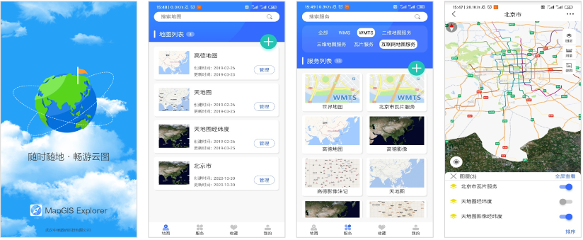
MapGIS Mobile Collector is a mobile data collector product used for data collection, management, editing, and sharing. It can collect and update multi-source data such as spatial information, attribute information, images, videos, etc

Figure MapGIS Mobile Explorer Product Function Display
Product Features
Fast integration from cloud to end
· Support MapGIS service standards, OGC standards, open-source map service standards, and other service resources
· One click connection to cloud GIS server, quick access to cloud based 2D and 3D map service data
· Integration of mobile map services, providing quick map browsing operations such as creating, browsing, and sharing maps
Efficient and user-friendly map browser
· Mobile map browser, providing offline/online map access mode, supporting data browsing such as vectors, images, terrain, and various 3D models
· Flexible layer management enables rapid stacking of various types of data, and map data fusion is evident
· Convenient map and scene settings, supporting global display settings, quick switching of base maps, etc., map browsing can be changed as needed
Convenient and practical tools
· Provide auxiliary tools such as search, measurement, screenshot, and bookmarking, with a focus on user experience and more user-friendly operation
· Real time positioning, relying on GPS, Beidou navigation and other positioning systems, displaying the user's precise location in real time
Related software
Desktop GIS
BD And Cloud Platforms
MapGIS CIM Basic Platform
Digital Twin Platform


