


Smart Geology
Provide information services based on geological resource related data to achieve deep mining, sharing, and exchange of geological resource information.
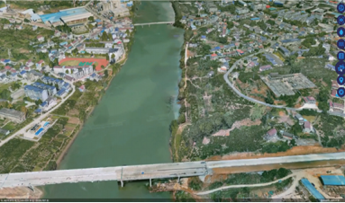
Zhongdi Digital closely adheres to the relevant requirements of the Ministry of Water Resources on smart water conservancy construction, and uses the independently controllable national production MapGIS platform as the GIS application support for the smart water conservancy digital twin platform to create the MapGIS digital twin watershed solution, which solves the problems of integrated management of all element information in the watershed, digital simulation of business, and expression of application scenarios, providing assistance for the construction of "2+N" water conservancy business application scenarios.
Technical Approach
Data Perception: Relying on water conservancy sensing networks, water conservancy information networks, water conservancy clouds and other information infrastructure, achieve comprehensive integrated management of monitoring perception data, basic geographic information data, and water conservancy business data;
Twin Platform: Based on the water conservancy integrated map, upgrade and expand the data foundation content, integrate the capabilities of GIS platforms and other platforms to build digital simulation engines and water conservancy knowledge engines, achieving digital reproduction of all-element information and water conservancy governance management activities;
Intelligent Applications: Based on the digital twin platform, around water conservancy business management needs, achieve interaction with users in a scenario-based manner, and support the expression of business decision-making content in digital form.

Construction Content
·Data Foundation
Based on unified standards, integrate historical data and existing business system data, and expand basic data, monitoring data, business data, geographic information data and cross-industry data according to actual business needs, achieve data governance, mining and sharing services, continuously optimize data fusion and analysis computing capabilities, and build a digital twin watershed data foundation. As a data service layer, the data foundation is based on current data sharing exchange protocols and specifically compatible with the capabilities of new data interaction protocols.
·Digital Simulation Engine
Integrate coupled multi-dimensional, multi-temporal and spatial scale, high-fidelity water conservancy professional mathematical models to achieve synchronized simulation operation of digital twin watershed and physical watershed.
·Water Conservancy Knowledge Engine
Based on water conservancy professional knowledge graphs, integrate business rules, historical scenarios and expert experience to achieve analysis and application of water conservancy knowledge.

Visualization Scenarios
Supported by technologies such as BIM, GIS, VR/AR/MR, and game engines, construct watershed visualization scenarios, propose visualization display paradigms for watersheds, water conservancy objects and phenomena, and provide support for precise decision-making.
·Integrated All-Element Information Scenarios
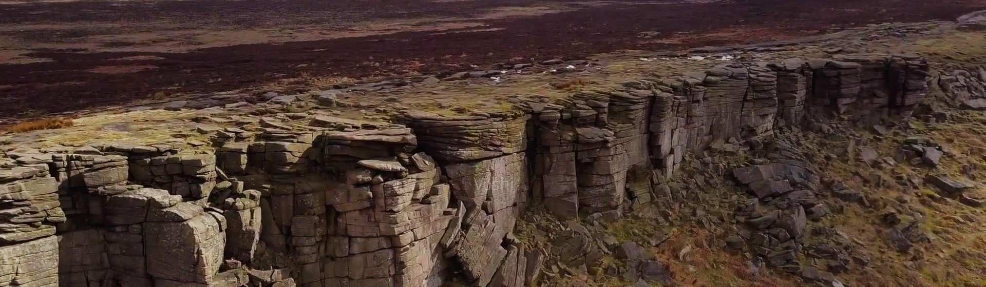
Achieve integrated display of all-element information including natural background around watersheds (such as different seasons day and night, different levels of wind, rain, snow, fog and other backgrounds), flow field dynamics (such as key areas such as reservoir tail, dam front, dam downstream, spillway, etc.), water conservancy projects (reservoirs, sluices, dikes, hydropower stations, pumping stations, irrigation areas, water diversion, check dams, sloping farmland, etc.); water conservancy mechanical and electrical equipment (pumps, sluices, etc.).

·Visualization Effects Based on Game Engines
MapGIS platform has achieved integration with game engines, creating an open and sustainable development ecosystem of "3D GIS + game engine", supporting high-quality rendering of 3D GIS scenes. Based on UE5, it builds virtual simulation scenarios, realizes digital expression of water conservancy business management scenarios and water conservancy professional knowledge, and provides technical support for twin applications and visualization simulation analysis of whole watershed scenarios.
Business Application Scenarios
As the core and key of smart water conservancy construction, the construction of digital twin watersheds will enhance the thorough perception capability of water conservancy information, provide sufficient "computing data" for driving water conservancy professional models and knowledge, accelerate the full-process upgrade of water conservancy business work, strengthen comprehensive analysis and decision support capabilities, solidify the foundation for in-depth integration of information technology and water conservancy business, and provide guarantee for the expansion of water conservancy business application scenarios.

Related Software
Smart City
- Smart City Spatiotemporal Big Data Platform
- MapGIS Smart Thermal Solution
- Smart Emergency Command Platform
- MapGIS Field Work Order Solution
- Enterprise One Picture Solution
- Smart Security Combat Platform
- MapGIS Pipeline GIS Solution
- Smart Chemical Industrial Park Solution
- Smart Patrol and Prevention Platform
- MapGIS Integrated Management System Solution for Underground Municipal Facilitie
Natural Resources
- National Land Space Basic Information Platform: Smart Hub
- National Spatial Planning Implementation Monitoring Network (CSPON)
- Real estate convenience service system
- Realistic 3D Solution
- Natural Resource Asset Management Solution
- One code land management solution
- Ocean monitoring solutions
- Intelligent Disaster Management Solution
- Integrated solution for natural resources e-government
- Land survey solution
Smart Geology
- MapGIS Digital Twin Watershed Solution
- MapGIS Groundwater Informatization Solution
- MapGIS Iterative Geological Modeling Tool
- Geological Informationization Solution
- MapGIS Geological Data Management and Display System
- MapGIS Field Data Collection System
- MapGIS Smart Environmental Protection Solution
- Integrated solution for urban geology above ground and underground
- Geological big data cloud platform
- MapGIS Mining Management and Modeling System
More Applications
- Series solutions for the communication industry
- MapGIS CIM Underground Space Platform
- Smart wind power solution
- Solution for Radio and Television Resource Management
- Transportation Meteorological Support Service Solution
- High performance processing solution for remote sensing images
- Multi source remote sensing data management solution
- Solution for Multi source Meteorological Information Integration Application and Service Platform
- Solution for Visualization Platform of Meteorological 3D Storm Body Echo Data
- Solution for Weather Radar Construction Business Platform


