


Welcoming the "flood" intelligent prevention, MapGIS intelligent drainage builds a new ecological system for urban flood prevention
National production of GIS base, building a safe and controllable digital base
Integration of Industry and Education in Welcoming the New Year, Zhongdi Digital collaborates with universities to create joint training programs for professional and master's degrees
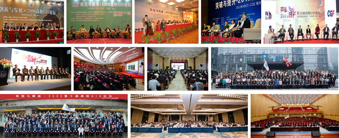
The 20th National Congress of the Communist Party of China proposed the integration of industry and education, and since the Third Plenum, it has emphasized the use oriented approach and the cultivation of students' employment oriented approach. After the expansion of enrollment in schools, there is an urgent need for abundant scientific research projects to comprehensively cultivate students' research abilities. Zhongdi Digital relies on its own resource endowment, actively responds to the call, and creates a talent training system of academic high-end exchange, technological innovation breakthroughs, and application practice verification, building a perfect practical carrier for industrial development and education and teaching. Developing one of the most authoritative high-end events in the domestic GIS education industry - the University GIS Forum, to recognize and encourage young representatives of teachers and outstanding students in the field of GIS in universities ..
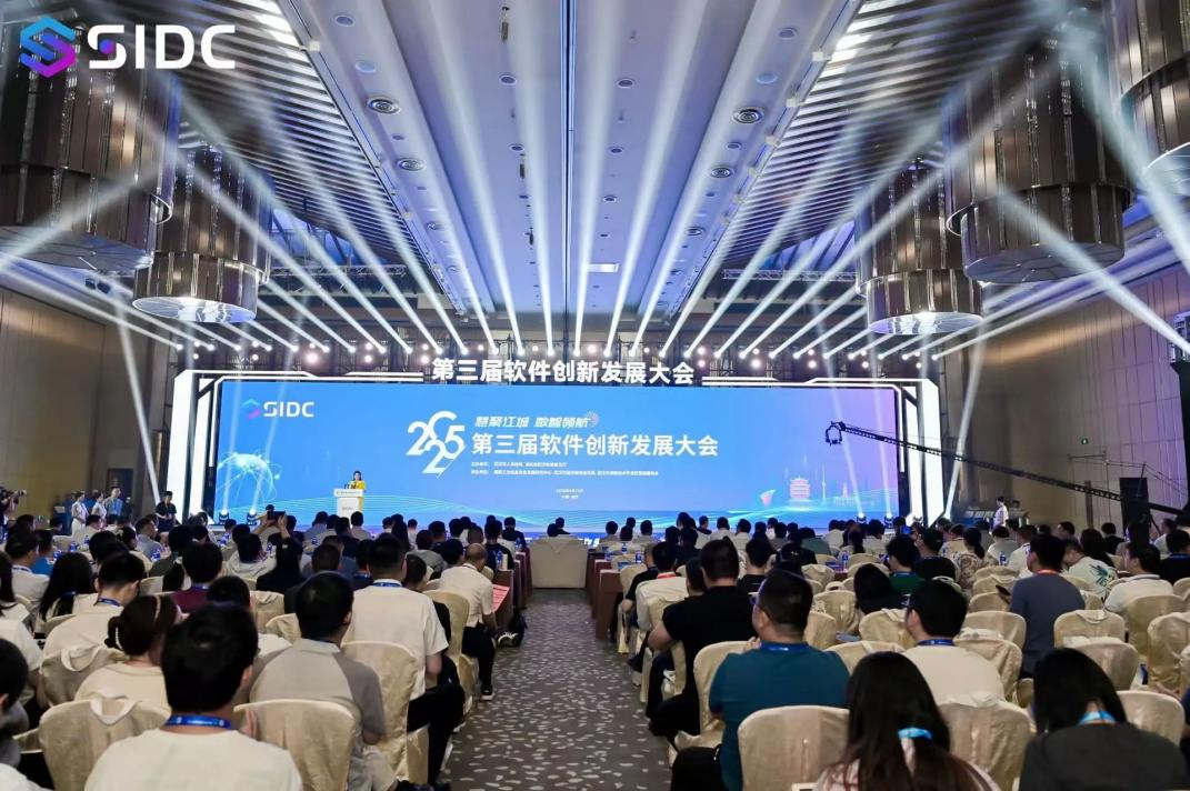
Zhongdi Digital made its debut at the 3rd Software Innovation and Development Conference, jointly building a new AI enabled domestic software ecosystem
Jointly advocating AI empowerment and promoting collaborative innovation of domestic software
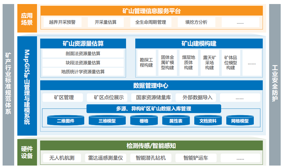
MapGIS provides insight into underground resources, empowering precise mineral exploration
As the "food" for industrial development, the exploration accuracy of mineral resources is directly related to the national strategic resource reserves.
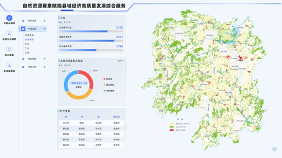
Case Practice | Empowering County Economy with High Quality Development through Natural Resource Data Elements
County areas are the regions with the richest resource endowments in China
The first notice of the 13th University GIS Forum 2025 on Intelligence and Collaboration has been released!
Based on universities, facing the whole country, promoting industries, and innovating applications


